State/Territory: New South Wales
Date this name and boundary was gazetted: 25 February 2016
First election for this name and boundary: 2016 federal election
Name derivation: Named after Ben Chifley (1885–1951), Prime Minister of Australia 1945–49.
Area: 126 sq km
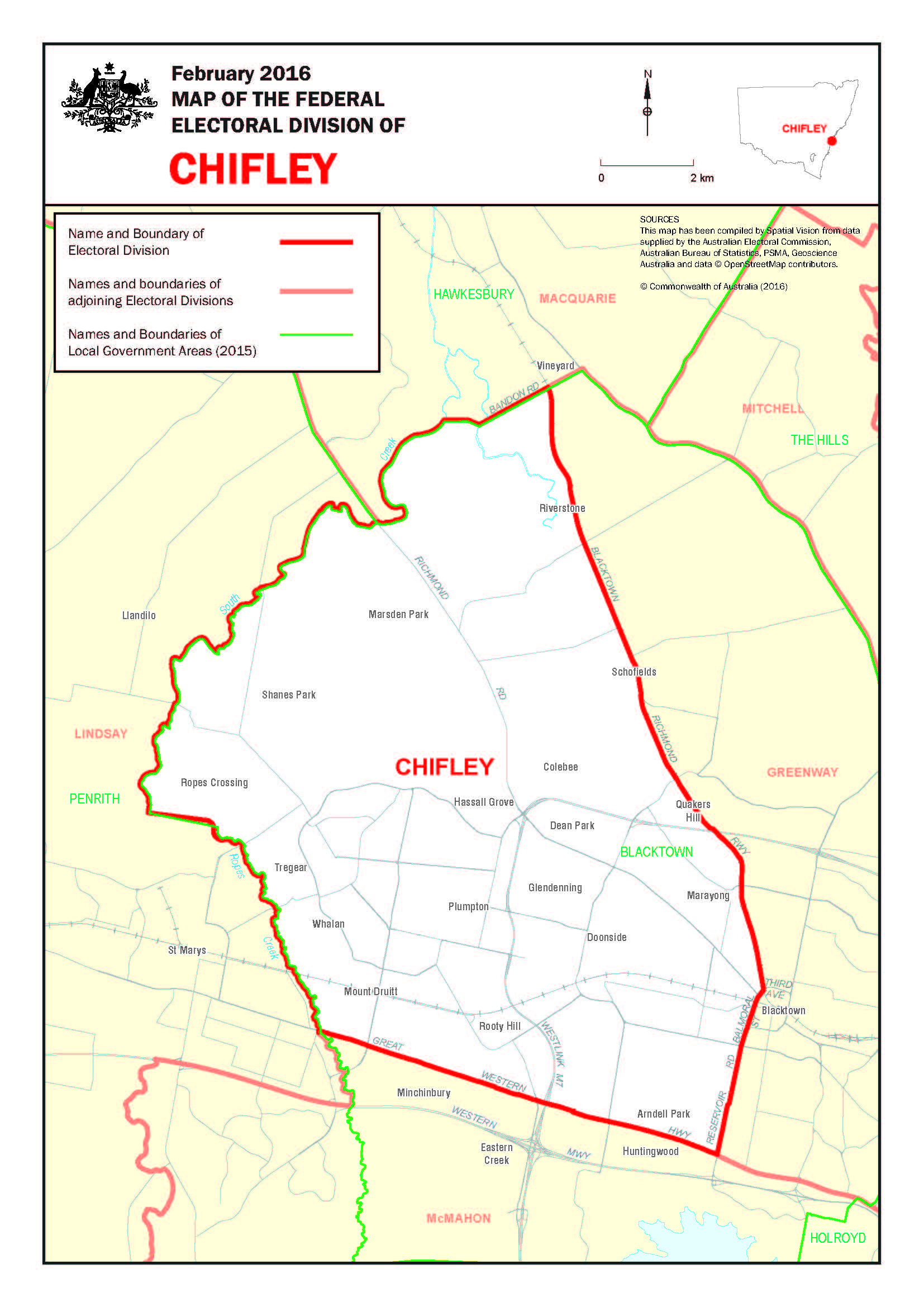
Location Description: Chifley covers an area from South Creek in the north to the Great Western Highway in the south. The division is borded by Blacktown-Richmond Railway, Reservoir Road, Balmoral Street and Third Avenue in the East, South Creek and Ropes Creek in the West. Suburbs include: Arndell Park, Blacktown (part), Colebee, Dean Park, Doonside, Glendenning, Hassall Grove, Marayong, Marsden Park, Mount Druitt, Plumpton, Rooty Hill, Quakers Hill (part), Riverstone (part), Ropes Crossing, Shanes Park, Schofields (part), Tregear and Whalan.
This description reflects local government areas in existence in 2015.
Products/industries of the area: Light manufacturing and service industries.
First proclaimed/election: 1968/1969
Demographic rating: Outer Metropolitan – situated in capital cities and containing large areas of recent suburban expansion.